 (
(
Chile
Chile
Blown away
Welcome to Patagonia. We’re headed for Isla Navarino, an hours-flight south that will take us below 50 degrees of latitude (cue the Furious 50s) and drop us off a mere three-days by cruise ship away from Antarctica, the windiest place on the planet. Once there we will hike. For five days. Sleeping in a tent.

Click to view gallery

The Dientes de Navarino could fairly be claimed as the world’s southern-most trek. While the famous Torres del Paine national park, 600km north, attracts around 250,000 visitors every year, Navarino welcomes a tiny fraction of that figure and only around 600 of them will hike the trail. There are no refugios here with cosy beds and hot showers at day’s end. The 53km Dientes route offers the landscape raw, as nature intended.
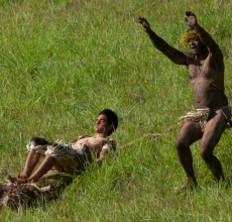
The plane whips with a tailwind across the snow-dusted peaks of the Darwin Range and the Beagle Channel to land at Puerto Williams behind which a jagged row of rocky snow-capped ‘teeth’ (‘dientes’ in Español) stand proud of forested green mountains. They’re not especially high – Picacho Diente is the tallest at 1118 metres – but the treeline at this latitude falls at around 600 metres which means hikers here face all the challenges of exposure and the weather that comes with it.
Click to view gallery
Click to view gallery
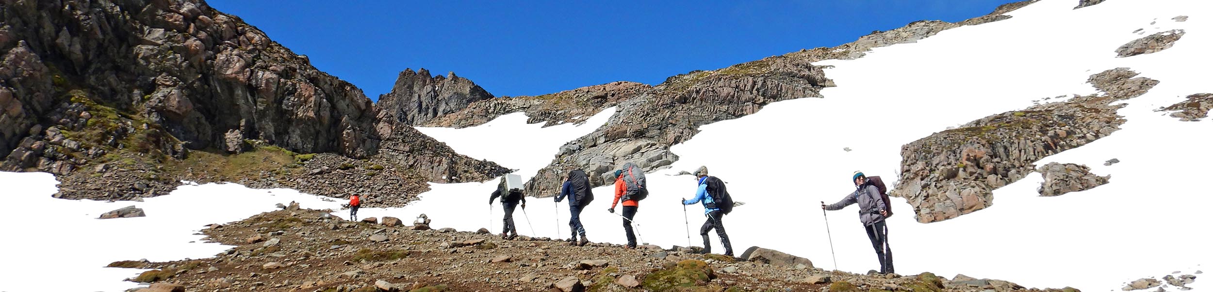
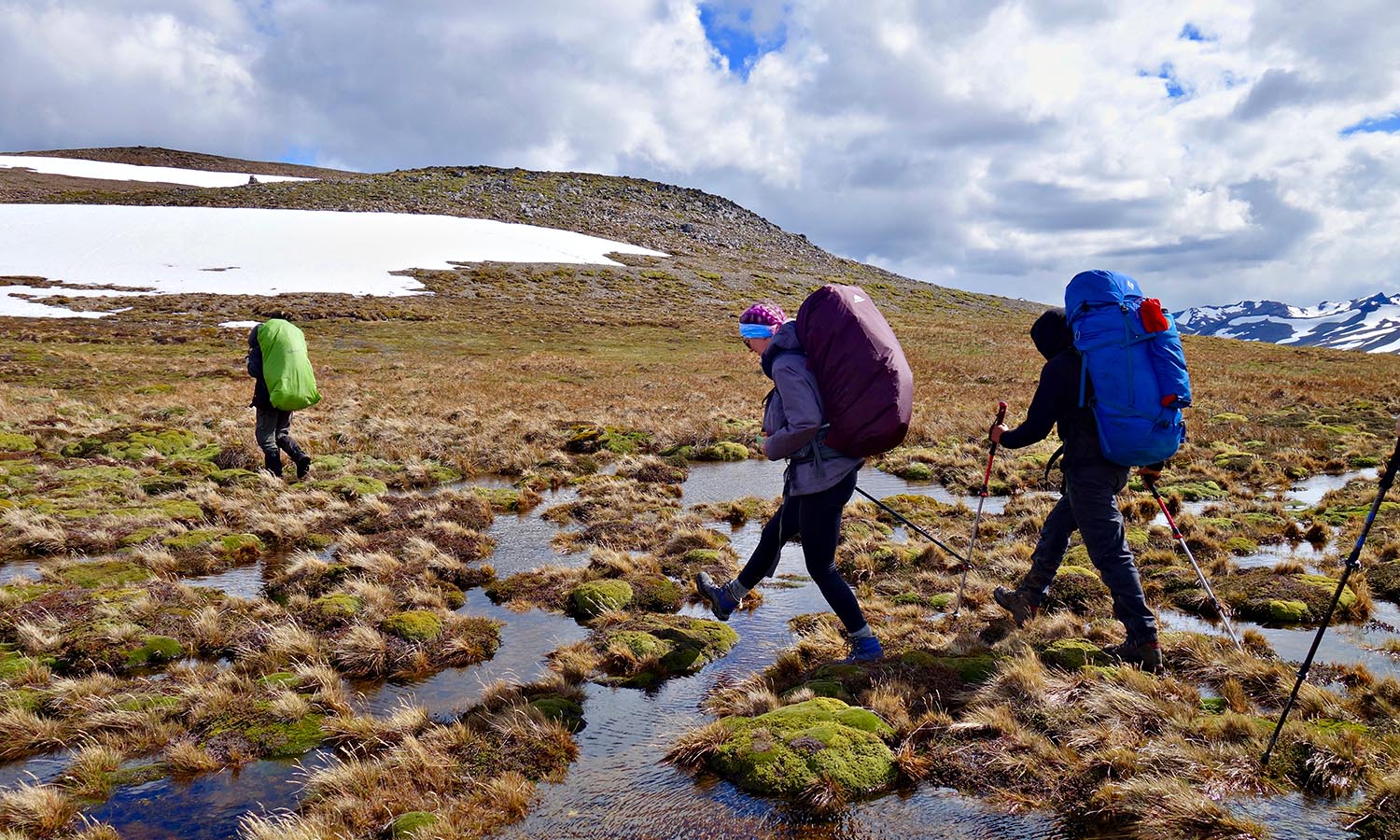
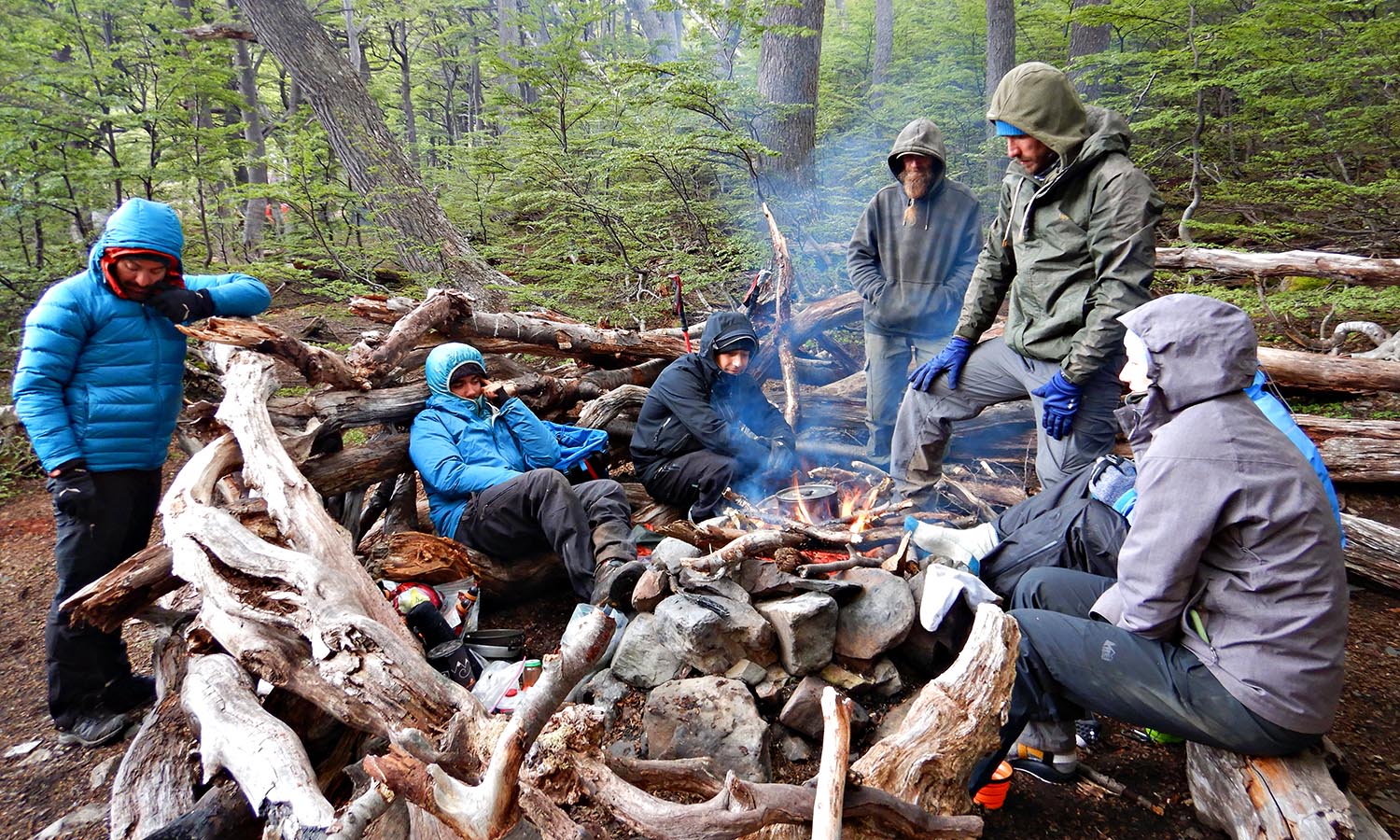
Our team comprises five hikers plus two guides, a cook and two porters from Chile Nativo. Within hours we’re on the trail and there is no gentle introduction. A 900-metre climb begins in muddy beech forest strung with moss and leafy lichens. Above the tree line, we hike open scree to traverse around the edge of a mountain, the terrain angled at 45 degrees with only a boots-width cutting through dumps of snow.
The stunning views are a powerful distraction from the business of walking but when I pause to rummage in my pack for some gloves to protect against the icy wind, porter Christobal advises, with a measure of seriousness, against lingering. We need to descend to camp.
Click to view gallery
Aside from the rugged terrain and 2.7 vertical kilometres to be climbed, it’s the elements that make this hike so challenging - the cold, snow and omnipresent wind. “You have to zip up your pockets otherwise everything flies away,” Gonzalo explains. “Anything you put on the ground you must pin down with a rock. Sometimes you talk and nobody hears you so you have to yell. It’s challenging but you get used to it.”
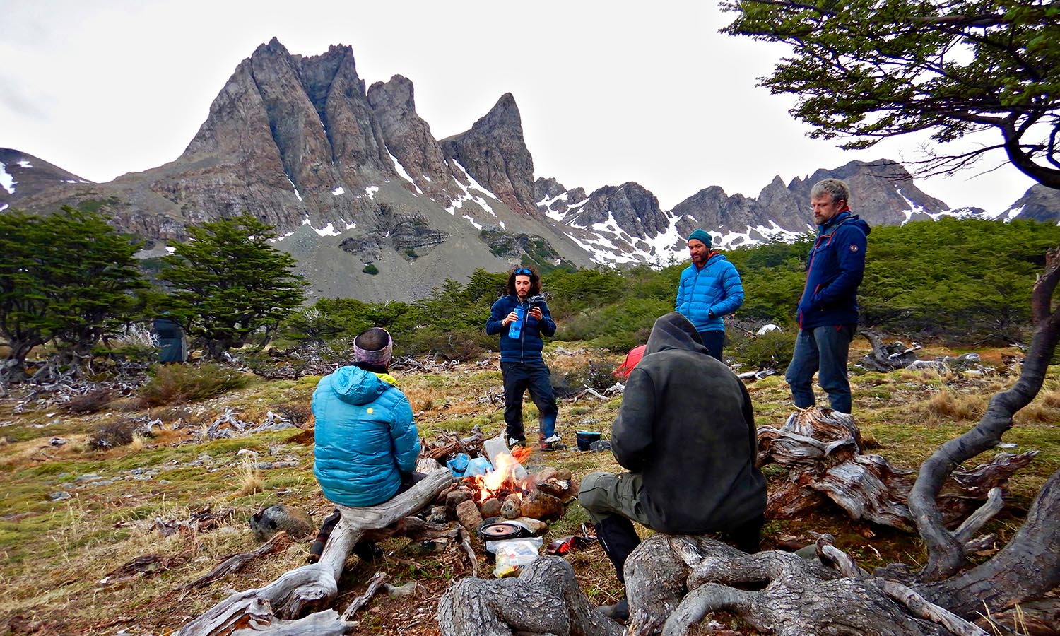
The relative shelter of Laguna Salto, cupped by the towering Dientes, is camp for the first night. The ground is boggy from snowmelt. Sporadic beech trees stand twisted and stunted like bonsai and waterfalls cascade into a lake fringed in ice floes. It’s stunning.
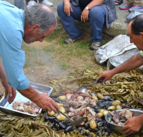
Our guides get busy preparing dinner - vegetable soup with king crab, a specialty of the region. Though we are each carrying most of our gear (food excluded) porter Pascal has been tasked with heroically carrying our quality but weighty tents. With all waste needing to be carried out of the wilderness area, Christobal has drawn the short straw, packing a toilet tent and its soon-to-accumulate contents. Our crap will be sealed in plastic bags before storage in a barrel labeled “Pirotecnicos” – presumably so no poor sucker will attempt to open it.
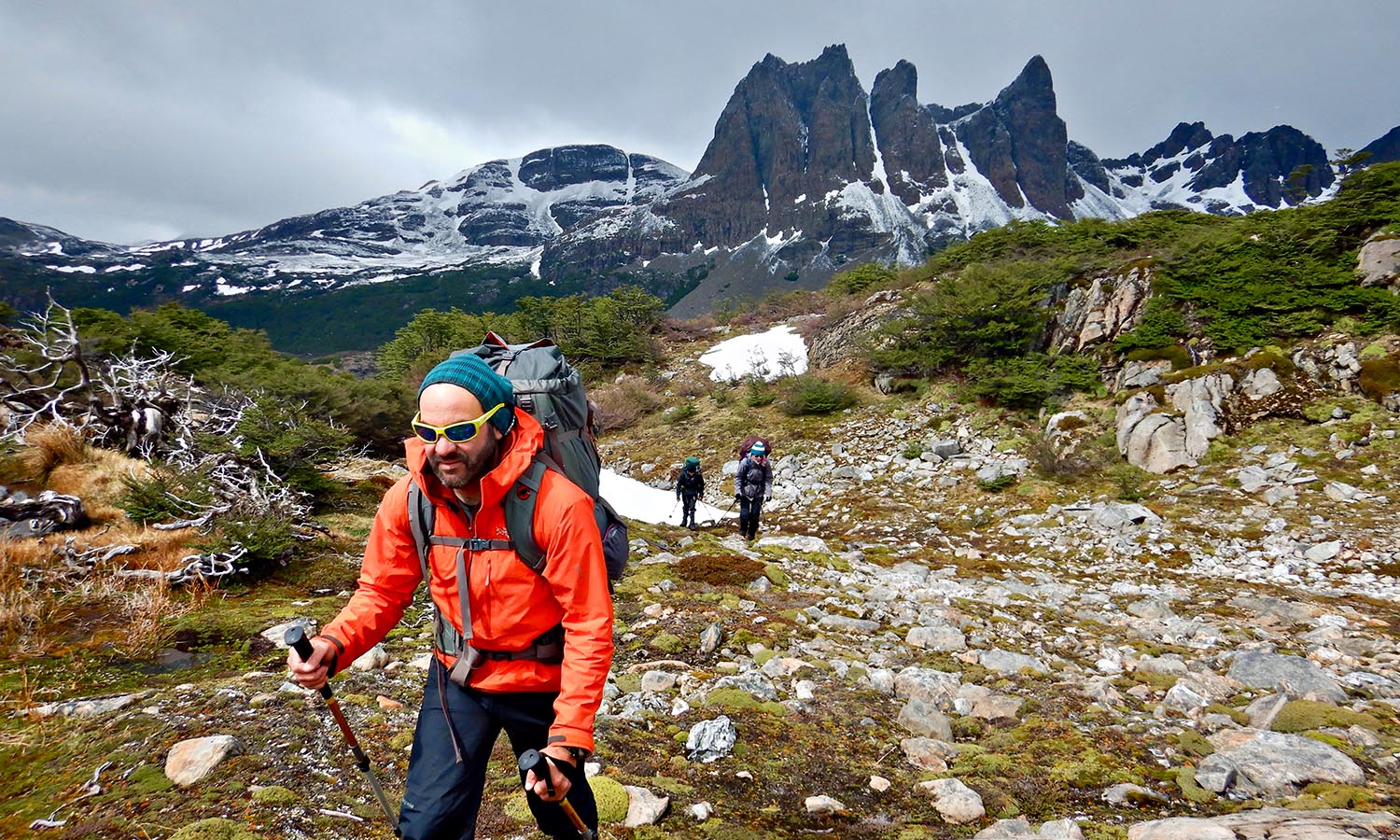
If the Dientes are teeth, on day two we floss them, our route cutting a high path between the towers. Traversing a high snow-covered valley, the striations in the rock faces looming over us appearing like the crimped folds of a merino’s fleece. A short side trip overlooks two frozen lakes, cracked and fringed in pale blue.

Click to view gallery
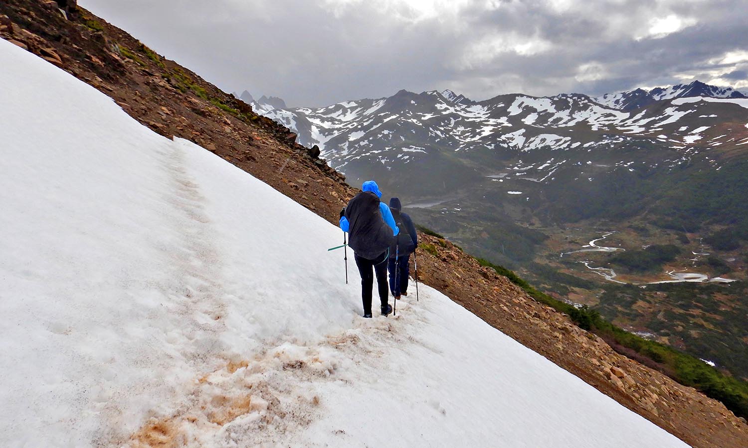
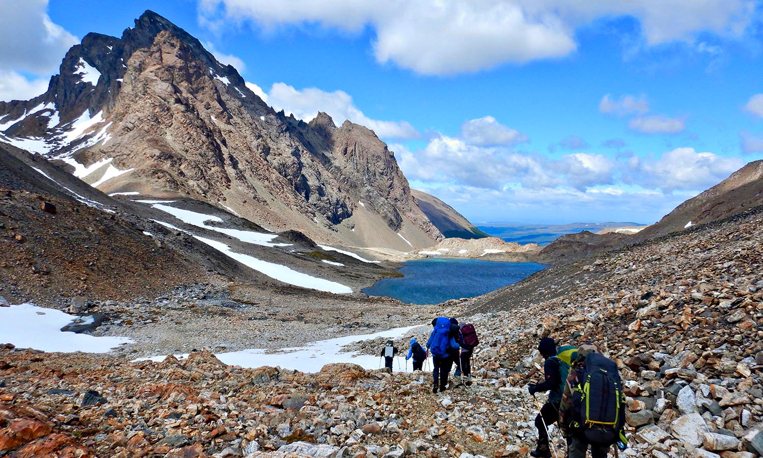
Gonzalo has issued us with spikes for our boots but, with the sun out, the snow is soft enough not to need them. Still, the trail runs perilous at times as it crests three passes and sidles across snow-covered slopes that fall away to jumbled rock and wind-whipped lakes.
Clouds move quickly, casting shadows that speed across the land. The wind is a bully that shoves suddenly and randomly, and on Paso Australia it’s so strong that I’m blown onto my butt. But guide Matias embraces the wind, seeing it as a challenge from God. “Try me! That’s all you’ve got?” he laughs, shaking a clenched fist at the sky.
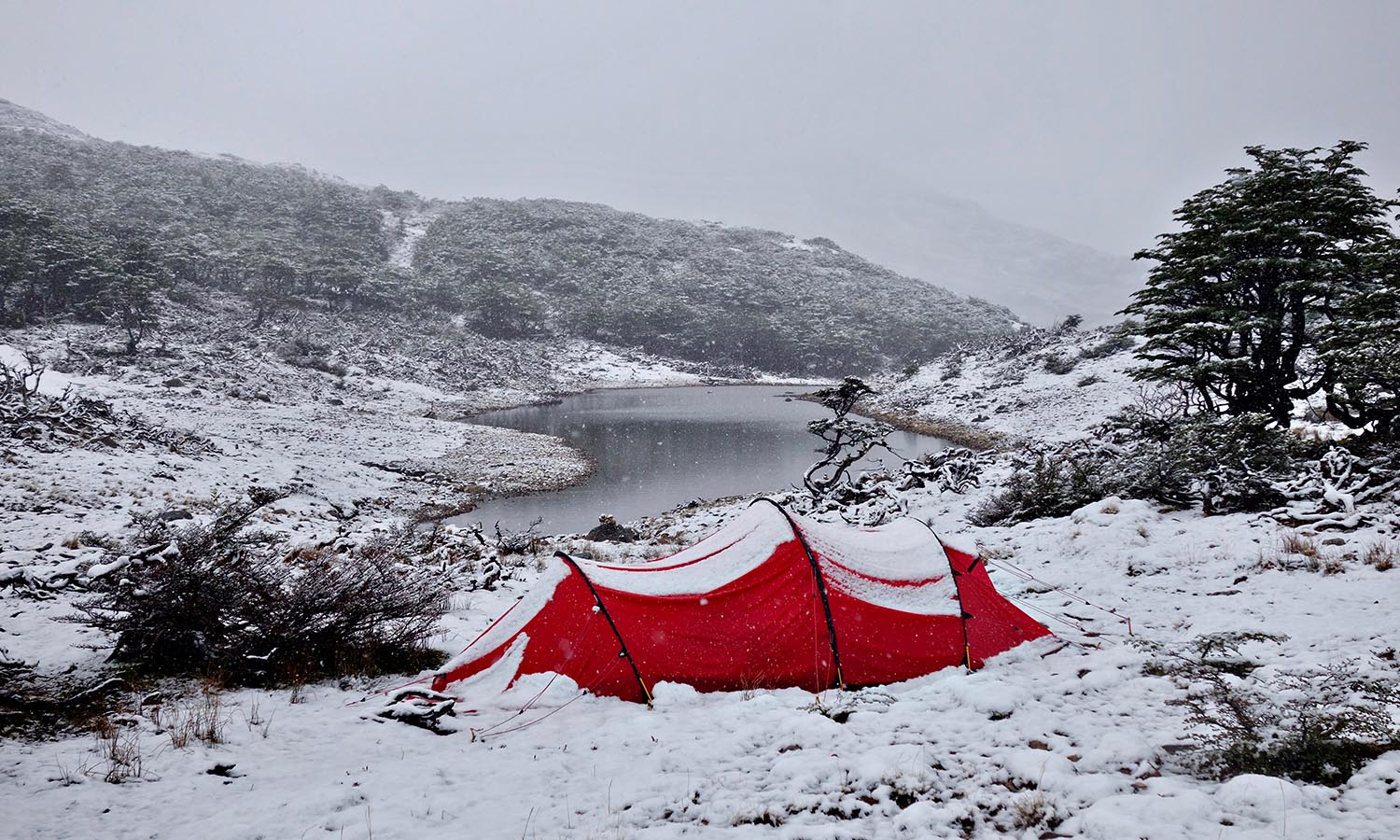
It means that nothing lasts long here. Weather shifts from bright sunshine to frigid hail and back again within minutes. But even with the sun out, it’s rarely warm. Daytime temperatures in the summer hiking season waver between three and eleven degrees but the wind chill makes it feel much colder.
Click to view gallery

Click to view gallery
Though conditions are challenging, the rewards are high. An afternoon walk up Mt Bettinelli, a shale covered plateau, offers immense views of the Dientes and beyond to Cape Horn, the famed headland where the Atlantic and Pacific Oceans collide in an often angry flexing of power.
It’s a remarkable landscape and every day gives our cameras a serious workout. We crest passes and descend into valleys, travelling from lake to lake, our jaws dropping in open-mouthed wonder. Green cushion plants provide splashes of green, and crystal clear lakes are tinged in blue. The land feels vitally alive, its story inextricably linked with the elements and how they shaped the land. This part of Tierra del Fuego is an extension of the Andes, layers of sedimentary rock that have been uplifted and then carved by glaciers. Only the hardy can survive in these conditions and the lichens that cling to rocks are as tough as pot scourers.

Click to view gallery
Click to view gallery
Despite being an experienced hiker I am glad to have guidance. Random trail markers painted onto boulders give occasional reassurance but mostly the route is a jumble of boulders, rock, scree and snow. “Some people come with no guide, no map, no GPS,” says Matias. “They say, ‘Oh I know about mountains so I will go with nothing,’ then they have problems.” Only a week earlier he was involved in a rescue when a couple’s tent blew away. “It’s dangerous but if you take care it’s okay.”
“This trail is much more wild than Torres del Paine. It’s harder for the guides too. Everything has to be carried in and out.” Guiltily, I consider my daily contribution to Christobal’s load.
Click to view gallery
Click to view gallery
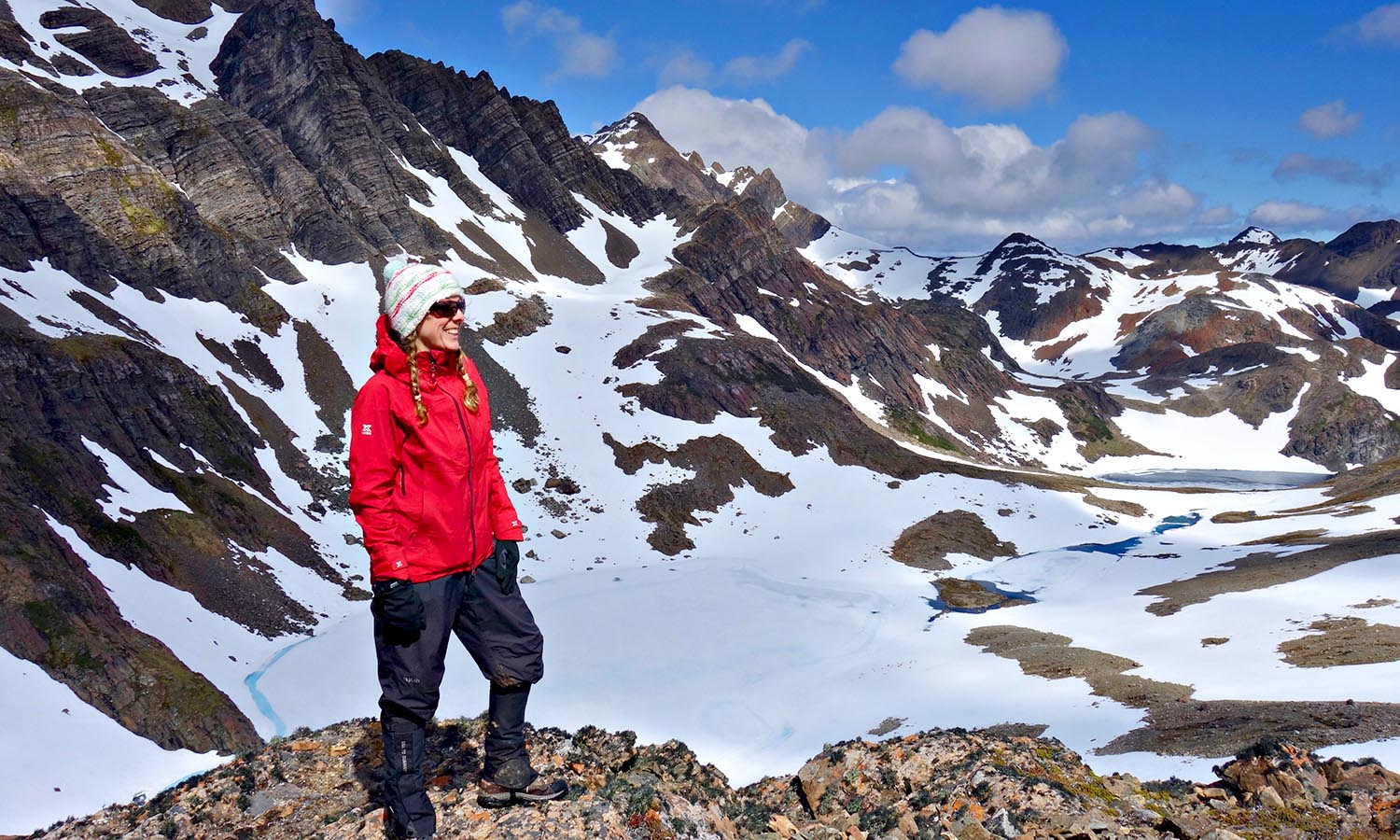
Thick snow falls the night before a 1000-metre climb to the plateau of Paso Virginia, the highest point of our route at 859 metres and considered the most dangerous. “In very bad weather you can see nothing,” Matias says. “If you’ve got hail in your face, 100kph winds and a backpack, you can’t walk for sure.”
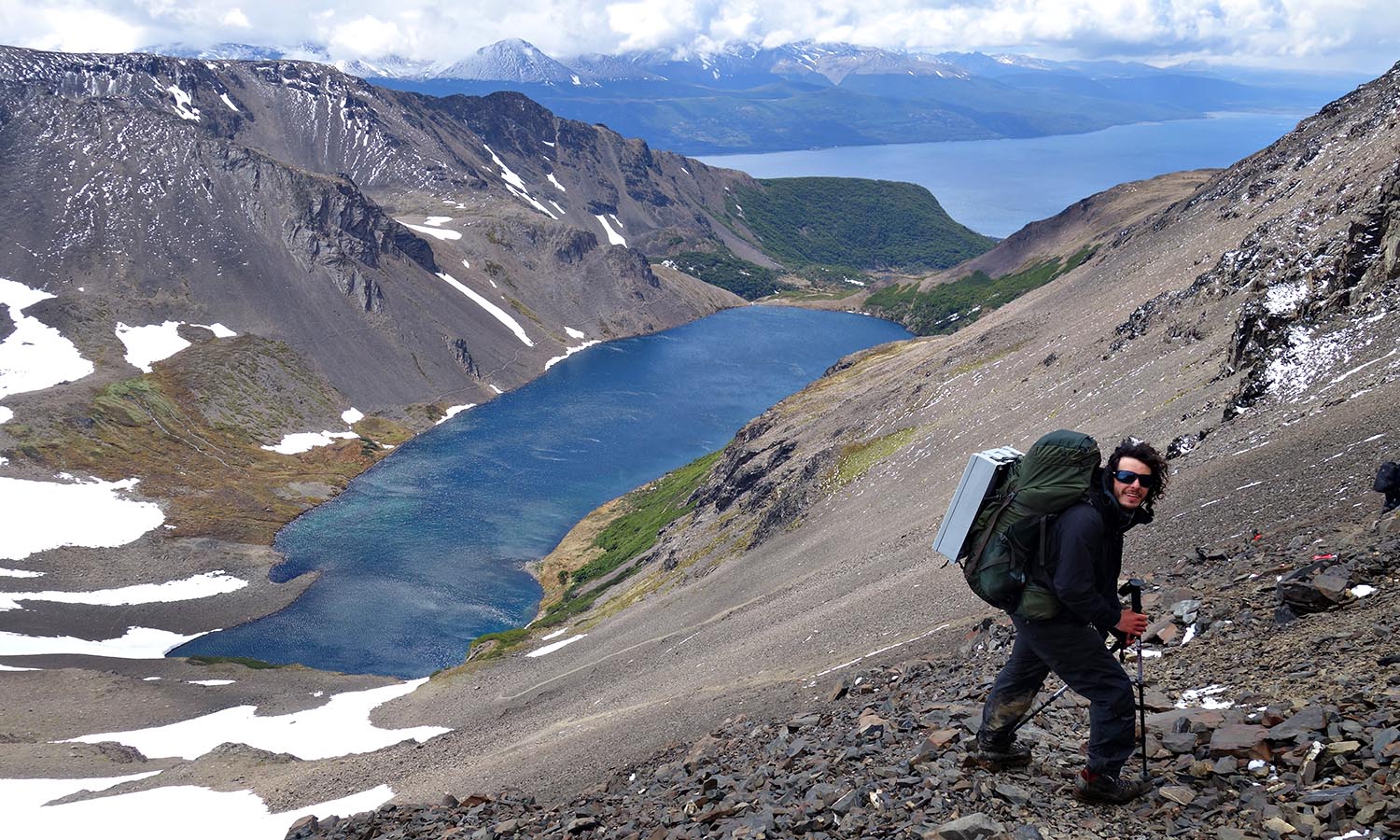
As it is, we cluster on a precarious lip, legs spread in a rock-god power-stance against the gale force gusts, to peer down at the most beautiful lake I’ve ever laid eyes on. Laguna Los Guanacos fills a long bowl cupped by snow-capped mountains. I’m mesmerised by its sapphire colour and emerald fringes, the way it drops off like an infinity pool at its far end, and how the wind whips across the water.
Click to view gallery
The descent to its shore is treacherous, a steep chute of rock and pebbles as slippery as ball bearings before softening into black ‘sand’. It takes ages, a marathon of steady foot placements braced by walking poles. “I had to hold a girl’s hand all the way down here once,” Matias says. There were tears.
By evening I’m feeling a bit snivelly myself. Days of walking in snow and mud has soaked my boots right through, and, with the temperature barely above freezing, my feet feel as though they’re soaking in an ice bucket.
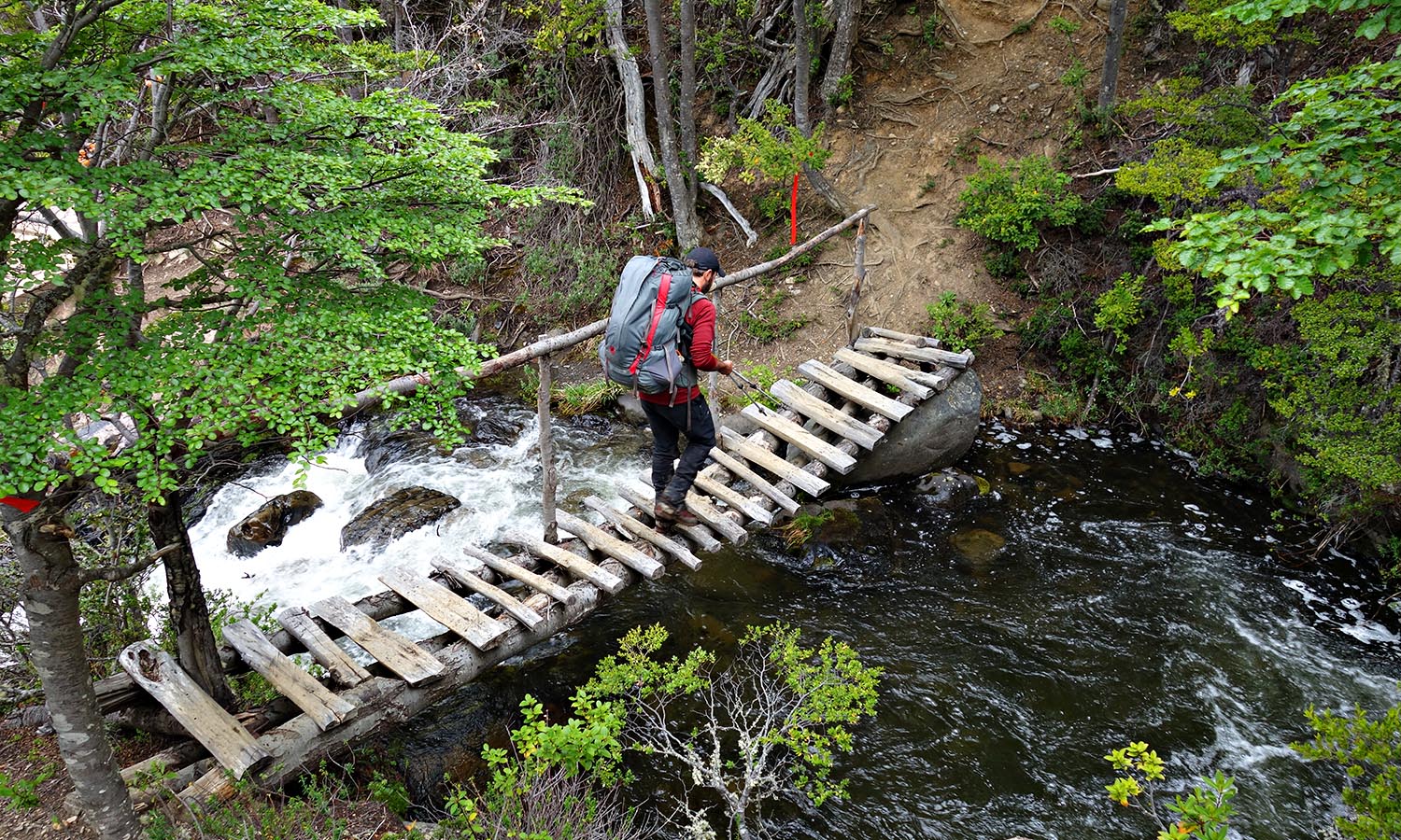
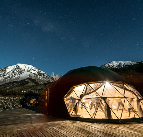
But eighteen hours later we descend through the forest to the luxury of Lakutaia Lodge and all struggles of the wild and woolly mountains we’ve traipsed through are forgotten, leaving only memories of its otherworldly beauty. On Isla Navarino the wind blew away all traces of the modern world, leaving only raw natural attraction and a reminder of what wilderness really is.
Get there
Qantas and Latam Airlines fly direct to Santiago from Melbourne and Sydney.
Latam provide connections to Punta Arenas. Chile Nativo organise the light aircraft onward to Isla Navarino.
Stay there
Hotel Yegua Loca in Punta Arenas is a restored 1929 house with the feel of a Patagonian estancia and primo views across the Strait of Magellan.
Tour There

Chile Nativo operate guided walks on the Dientes de Navarino circuit during the trekking season Dec-Apr. Prices start at US$2395 per person and include return flights from Punta Arenas to Isla Navarino, 4 nights camping, 1 night lodge in Puerto Williams, all meals and guides.

While you're here

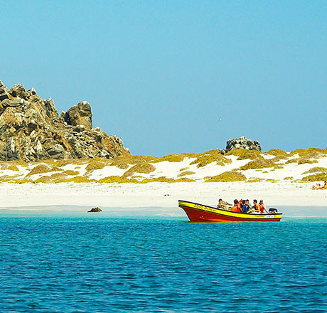
CHAñARAL, CHILE
There is only one way to get to the tiny rocky outcrop of Isla Damas, one of...
There is only one way to get to the tiny rocky outcrop of Isla Damas, one of three making...
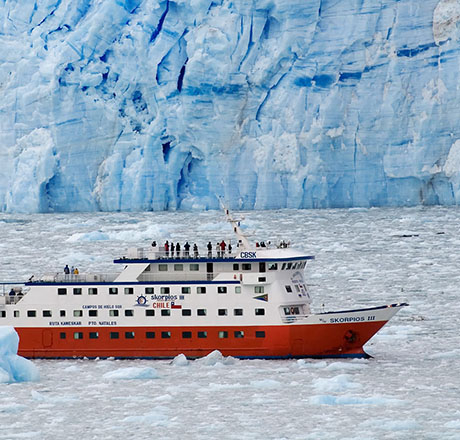
FIORDO CALVO, CHILE
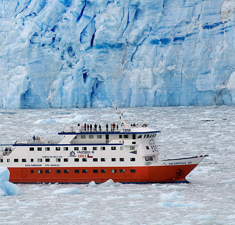
If global warming has taught us anything, it’s the realisation that some of...
If global warming has taught us anything, it’s the realisation that some of the...
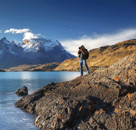
TORRES DEL PAINE, CHILE
If you want non-stop action – hiking, kayaking, bike riding, whitewater...
If you want non-stop action – hiking, kayaking, bike riding, whitewater rafting – G...
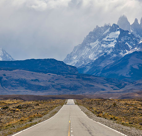
CHILE
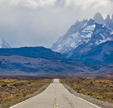
There’s no doubt Chile is one long, thin nation, so there’s no better way...
There’s no doubt Chile is one long, thin nation, so there’s no better way to discover...